


Share This Article
Article Summary
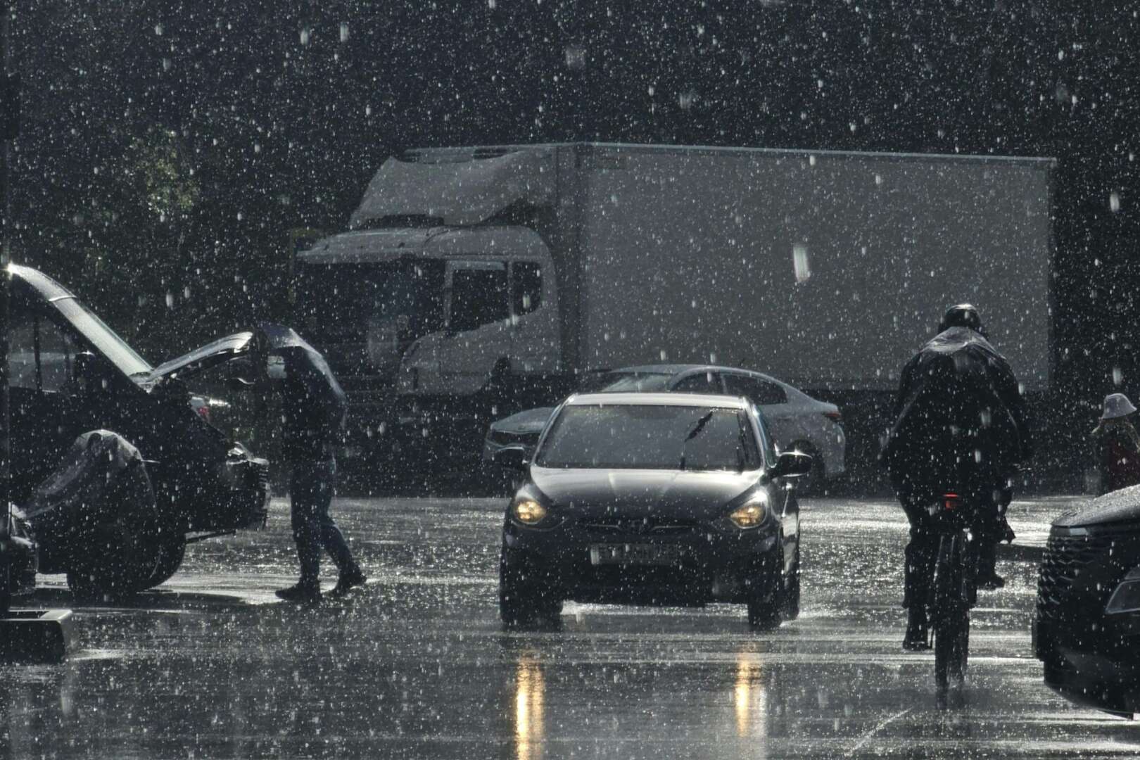
Greater Cincinnati faces an elevated flooding threat as multiple rounds of showers and thunderstorms move through the region from Monday through Wednesday. The National Weather Service warns that heavy rainfall could lead to localized flooding, flash flooding, and hazardous travel conditions in parts of southwest Ohio, Northern Kentucky, and Southeast Indiana. Forecasters expect the heaviest rainfall to occur between Monday night and Tuesday night. Officials advise residents to monitor weather alerts and avoid driving through flooded roadways as conditions develop.
Greater Cincinnati residents face a heightened threat of flooding this week as a prolonged stretch of rain and thunderstorms moves through southwest Ohio, Northern Kentucky, and Southeast Indiana.
Forecasters say repeated rounds of precipitation could overwhelm drainage systems and lead to flooding in low-lying areas.
The National Weather Service office in Wilmington expects showers and thunderstorms to continue from Monday through Wednesday. Meteorologists warn that some storms may produce heavy rainfall in a short period, increasing the risk of flash flooding across the Ohio Valley.
According to the National Weather Service Wilmington office, the region faces a threat of excessive rainfall that could create flooding concerns in urban areas, along creeks, and on roadways with poor drainage.
Local officials urge residents to monitor forecasts and remain alert for changing weather conditions throughout the week.
Flood risk Cincinnati remains elevated through Wednesday
Forecasters expect the heaviest rainfall to occur between Monday night and Tuesday night. Rain chances remain high throughout the period, with thunderstorms capable of producing intense downpours.
The National Weather Service forecast for Cincinnati shows widespread precipitation continuing into Wednesday morning before conditions gradually improve later in the day. While not every location will experience flooding, repeated storms moving over the same areas could significantly increase runoff.
The agency advises drivers to avoid flooded roadways and use caution during periods of heavy rain. Even shallow water can make roads dangerous and difficult to navigate.
According to forecasts published by the National Weather Service Forecast Center, rainfall totals may vary significantly depending on storm track and intensity.
Key concerns include:
- Flash flooding in urban neighborhoods
- Water accumulation on roads and highways
- Rising creek and stream levels
- Delays to outdoor events and activities
- Reduced visibility during heavy rainfall
Meteorologists note that conditions can change quickly when multiple storm systems affect the same region over several days.
Other news outlets report growing flood risk Cincinnati concerns
Several regional media organizations have highlighted the potential flooding threat.
According to reports from WLWT, forecasters warned that repeated rounds of rain could increase the risk of localized flooding across Greater Cincinnati. The station reported that saturated ground conditions in some areas may worsen runoff concerns if heavier rainfall develops.
Reported by WCPO 9, meteorologists also emphasized the possibility of strong thunderstorms accompanying the rainfall. Their coverage noted that rainfall amounts could vary widely across the region, making localized impacts difficult to predict.
Regional forecasts from multiple weather providers generally agree that the greatest concern comes from repeated storms rather than a single weather event. This pattern increases the chance that some communities could receive significantly more rainfall than neighboring areas.
Weather experts continue to monitor rainfall totals and forecast updates as the system progresses through the Ohio Valley.
How residents can prepare for flood risk Cincinnati conditions
Emergency management officials encourage residents to stay informed and take precautions before storms arrive.
Residents should monitor weather alerts through trusted sources and have multiple ways to receive warnings. Flash flood warnings can be issued with little advance notice when rainfall intensifies rapidly.
Officials recommend the following steps:
- Check local weather forecasts regularly
- Avoid driving through flooded roads
- Clear storm drains near homes when safe
- Secure outdoor items before storms arrive
- Keep mobile devices charged in case of power outages
The National Weather Service continues to stress the importance of the “Turn Around, Don’t Drown” safety message. Many flood-related deaths occur when drivers attempt to cross flooded roadways.
Local emergency agencies also encourage residents living near creeks and flood-prone areas to remain especially vigilant during periods of heavy rainfall.
Flood risk Cincinnati highlights a wet start to June
The expected rainfall marks another period of unsettled weather for the Greater Cincinnati region. Meteorologists say the current weather pattern continues to draw moisture into the Ohio Valley, creating favorable conditions for repeated showers and thunderstorms.
While widespread river flooding is not currently forecast, localized flooding remains the primary concern. Smaller waterways, drainage systems, and low-lying roads typically respond more quickly to intense rainfall than larger rivers.
Weather officials emphasize that flooding impacts can vary significantly within short distances. One neighborhood may receive only moderate rainfall while another experiences torrential downpours capable of causing flash flooding.
Residents should continue monitoring forecast updates through midweek as meteorologists refine rainfall projections and assess potential impacts.
As storms continue through Wednesday, forecasters say staying informed and exercising caution will remain critical for residents across southwest Ohio, Northern Kentucky, and Southeast Indiana.
FAQs
Why is there a flooding risk in Greater Cincinnati this week?
The flooding risk stems from repeated rounds of showers and thunderstorms expected through Wednesday. Multiple storms moving across the same areas can produce excessive rainfall and increase runoff into streets, creeks, and low-lying locations.
When is the greatest threat of flooding expected?
Forecasters indicate the highest risk period is from Monday night through Tuesday night. Rain and thunderstorms are expected to continue into Wednesday morning before conditions begin to improve.
What types of flooding are most likely?
Localized flooding and flash flooding are the primary concerns. Urban areas, poor-drainage locations, small streams, and low-lying roads can experience flooding more quickly than larger rivers.
What should residents do during a flood warning?
Residents should move to higher ground if flooding develops and follow instructions from local authorities. Drivers should never attempt to cross flooded roadways because water depth and road conditions may be difficult to determine.
